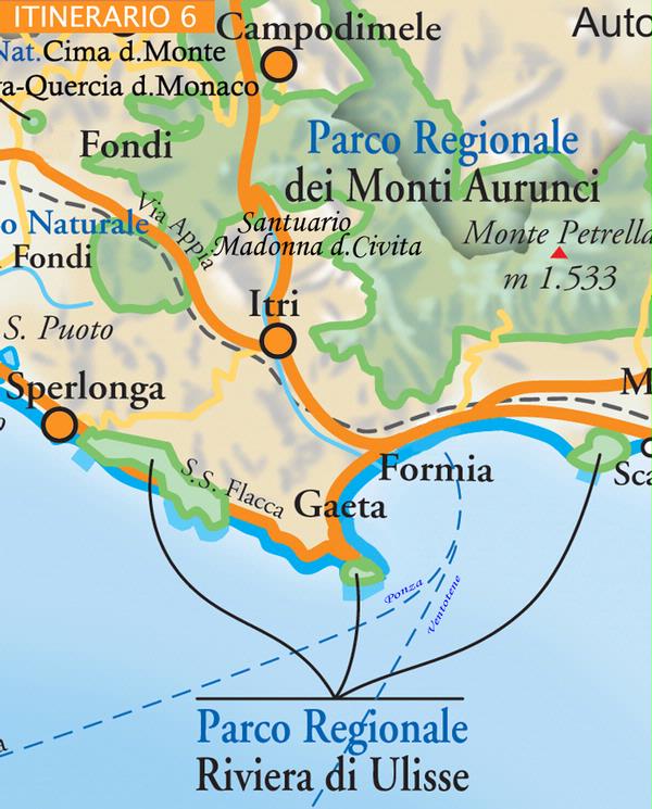
ITINERARIO SPERLONGA - ITRI- SANTUARIO DELLA CIVITA – CAMPODIMELE - SPERLONGA
Torna all'elenco
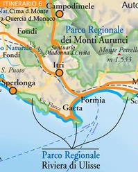
(Length: about 60 km. Between the sea and the Ausoni and Aurunci mountains). Located on a rocky spur of Colle S. Magno, SPERLONGA is an ancient fishing village and a famous seaside resort whose centre is typically Mediterranean in appearance, with white houses, tiny lanes and stairways descending the steep cliff directly to the sea. Proof that the area was occupied in Roman times can be found in the ruins of an Imperial Villa (visible from Via Flacca) and Tiberius’ Grotto, which is located at the southern most tip of Angolo beach. Many of the marble statues found in the archaeological area are now exhibited in Sperlonga National Archaeological Museum. The area is also part of the natural monument of the Promontory of Tiberius’ Villa and the Torre Capovento-Punta Cetarola coast, all of which is included in Riviera di Ulisse Regional Park. The fortifications and ruins of the gates in the city walls date back to medieval times as do the former church of Santa Maria Assunta in Cielo and the church of San Rocco. Below the village, at sea level, lie the delightful Angolo and Canzatora beaches, the port and the Truglia tower. Heading inland from Sperlonga along the ridge of the mountain, we can reach the hillside village of ITRI (170 metres above sea level). Split in two by the Via Appia, one side of the village stretches as far as the sea and includes an imposing medieval castle (restored), the collegiate church of San Michele Arcangelo, the bell tower of the destroyed church of Santa Maria Maggiore, while the other side of the village includes the church of Annunziata. Taking the SS 82 out of the centre of the village, for about 10 km, it is possible to reach the sanctuary of Madonna della Civita (Monte Fusco, 670 metres above sea level) in which there is a beautiful icon of the Virgin Mary as well as a fine collection of ancient and modern votive offerings. Another place of interest in Itri is the Museum of Brigandage. On the outskirts of the village and especially in the gorge of Sant’Andrea, there is a perfectly preserved stretch (about 2 km) of the ancient Roman Via Appia and an ancient Roman wall. The road also passes the ruins of a Bourbon fortress. On the SS 82, inland, CAMPODIMELE (647 metres above sea level) is a hilltop village located at a mineral water spring in a suture between the Ausoni and the Aurunci mountains just in front of Mount Faggeto (1259 metres above sea level). The medieval village centre is surrounded by a restored city wall with twelve cylindrical towers, reachable through a ring-road. Among the religious buildings in the village are the church of San Michele Arcangelo and the church of Madonna delle Grazie, while the Piazzetta del Comune offers a beautiful view over the valley. Outside the village, it is possible to visit the restored monastery of Sant’ Onofrio. Campodimele lies at the centre of the regional park of the Aurunci mountains which covers a total surface area of 47,385 hectares. Furthermore, it has been statistically proven that Campodimele is the municipality with the longest living population in Italy, a fact which has resulted in the village being known as the ‘village of long life’. The return trip ends to Sperlonga.